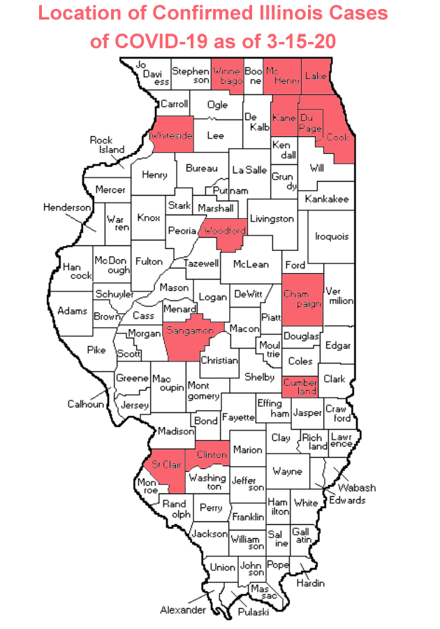
Here is an updated map of the counties where COVID-19 cases have been confirmed in Illinois.
Sunday (3/15) the Illinois Department of Public Health (IDPH) announced the total number of confirmed cases in Illinois had risen to 93. Below is a map of the counties where at least one confirmed case has been found.
Remember, you can make the best plan for you and your family by visiting the McLean County Health Department website, the IDPH website and/or the Center for Disease Control (CDC) website for all the latest information.
By: Buck Stevens