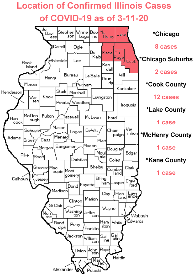
The number of cases of Coronavirus in Illinois has risen to 25 as of yesterday (3/11).
The Illinois Department of Public Health (IDPH) announced six new confirmed cases of COVID-19 in Illinois yesterday to bring the total to 25. If you are like me, you might want to know where these cases are located. Here is the answer to that question as I was able to find.
While a woman who was confirmed to have COVID-19 traveled through Bloomington-Normal on an Amtrak train. However, there has been no confirmed cases of Coronavirus in McLean County or the surrounding areas yet.
Illinois State University has extended their spring break to prepare staff and professors on how they will move forward in light of the pandemic.
Local events have been cancelled to be proactive instead of reactive to the Coronavirus. The decisions are being made for health and safety concerns for the public as a whole. The smarter we are right now the less this situation will affect us here locally.
You can make the best plan for you and your family by visiting the McLean County Health Department website, the IDPH website and/or the Center for Disease Control (CDC) website for all the latest information.
By: Buck Stevens