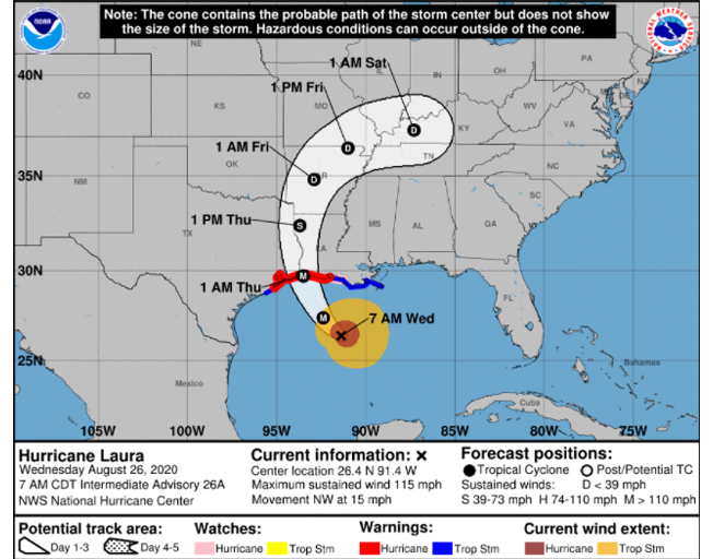
Hurricane Laura is strengthening as it heads toward landfall on the Gulf Coast in the Texas-Louisiana region.
Just days after Tropical Storm Marco lost power before pounding the region with heavy rainfall, Laura is gaining power as it prepares to pound the same region.
Laura has grown to a Category 3 storm and is likely to be a “catastrophic” Category 4 hurricane by the time it makes landfall late tonight or early tomorrow morning between Houston, Texas and Lake Charles, Louisiana.
A Category 3 hurricane has wind speeds of 111-129 mph. A Category 4 hurricane has winds of 130-156 mph. The National Oceanic and Atmospheric Administration (NOAA) describes the type of damage caused by a Category 4 hurricane as follows:
“Catastrophic damage will occur: Well-built framed homes can sustain severe damage with loss of most of the roof structure and/or some exterior walls. Most trees will be snapped or uprooted and power poles downed. Fallen trees and power poles will isolate residential areas. Power outages will last weeks to possibly months. Most of the area will be uninhabitable for weeks or months.”
It appears based on the projected path of the storm that we could potentially get some precipitation in the Central Illinois area sometime Friday night or Saturday.
Our thoughts and prayers are with everybody in the path of the storm.
By: Buck Stevens


